


Someone kindly sent me a copy of this photo, this is not my photo. It says taken on Langdon Hills. If you look carefully you can see the Laindon to Southend Railway and in the distance I believe St Nicholas Church. Now I believe I can see the old railway crossing that was opposite Gladstone Road and also the very large tree that was growing close to the road that I believe to be Gladstone Road. As I remember it, there were a couple of small dwellings, then a large double storey house then back to smaller dwellings, half way up a road to a farm. Now I am hoping the person that took the photo was standing quite close to Fenella, Gladstone Road. Any one help me out here? Frieda Fordham.
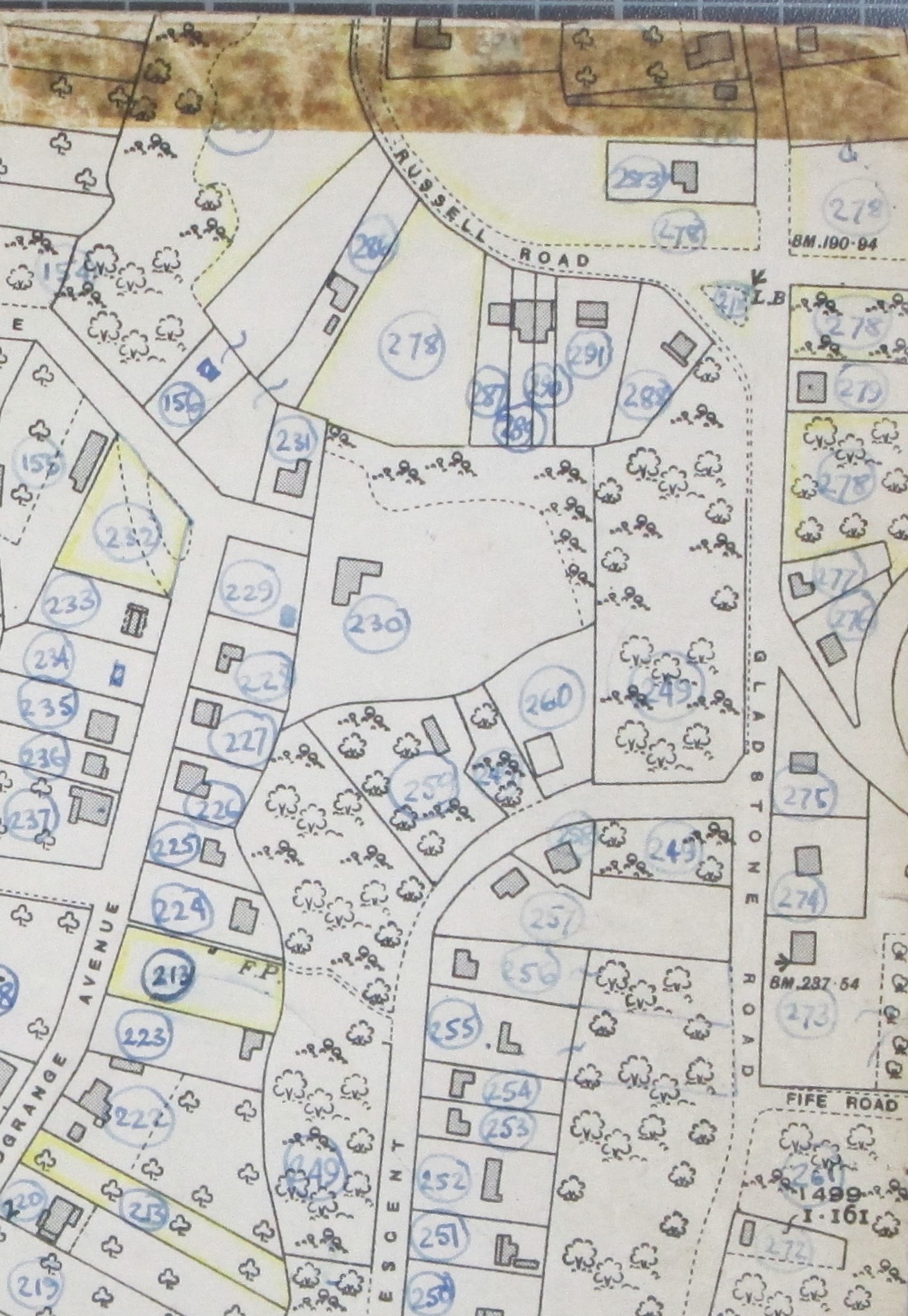
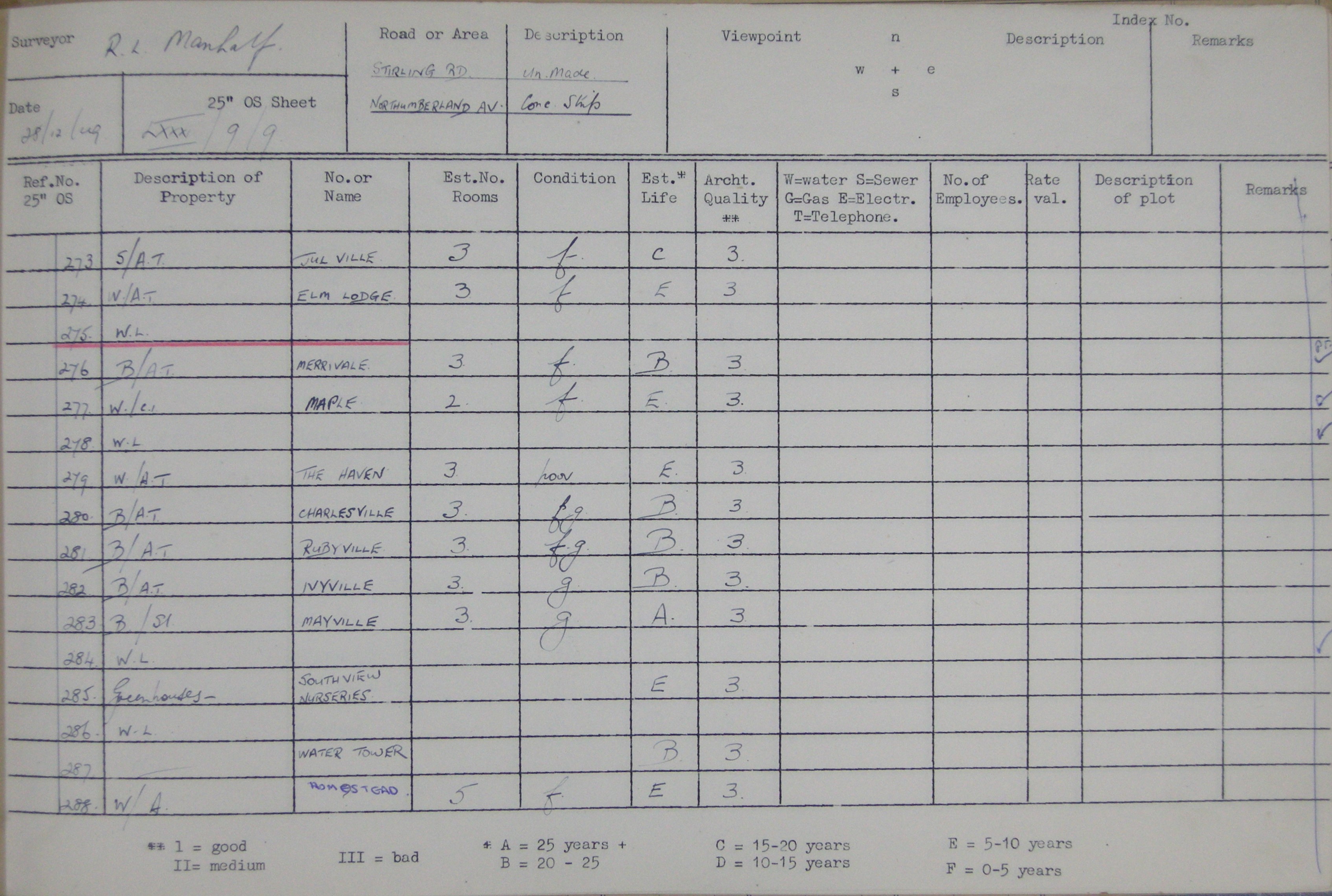
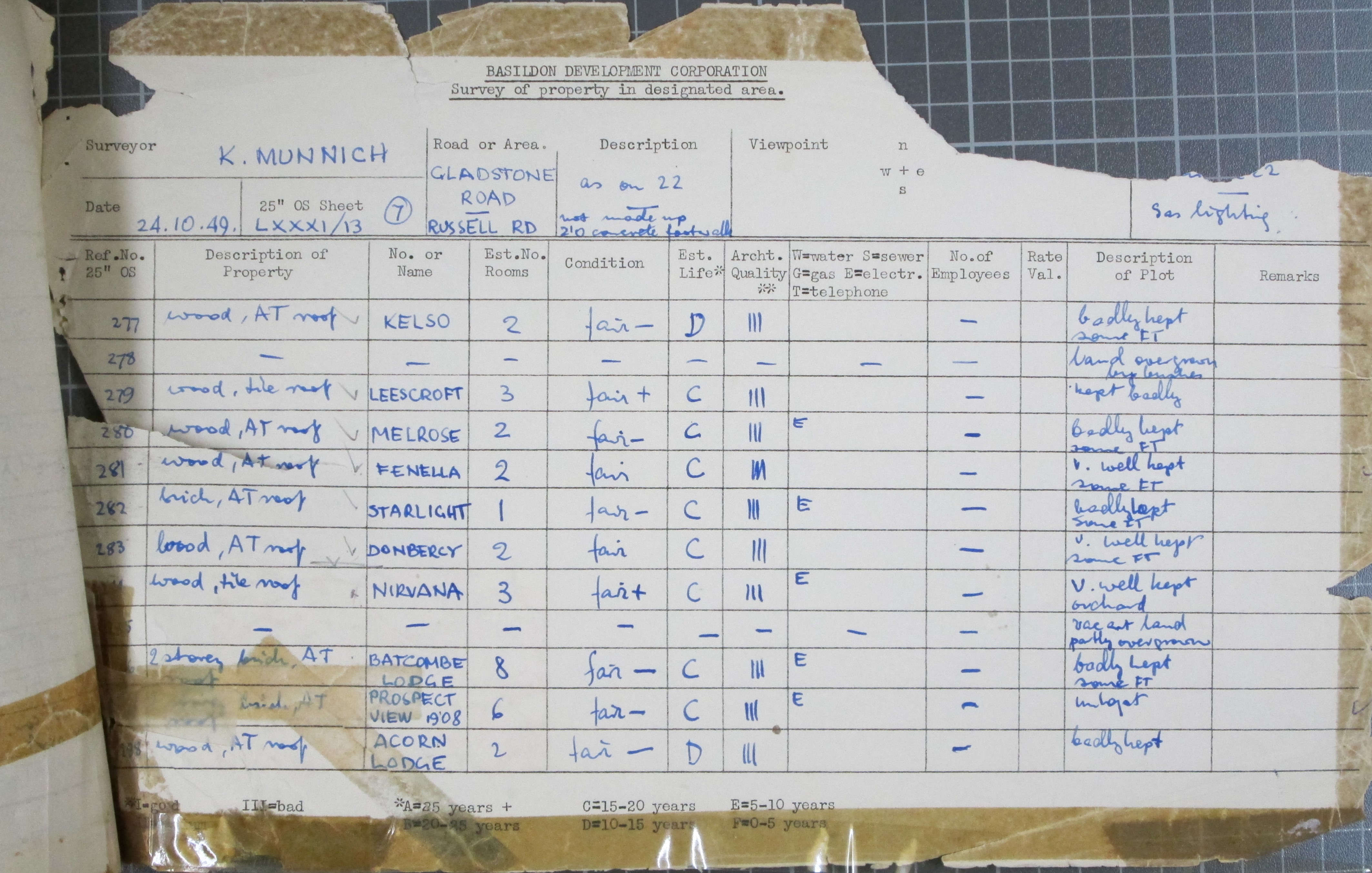
Editors: We have added two maps taken from the 1949 BDC Survey, they show the area that is displayed in the postcard photograph. The photograph would have been taken in a location between Gladstone Road and Russell Road probably very close to ‘Fanella’. Also included are two survey lists that show details of the plots, one shows the water tower which is a useful landmark and the other shows details of ‘Fanella.
The text below was added by the editors.
The photograph would have been taken from a high point somewhere between Russell Road and Gladstone Road. If you are able to zoom into the picture you can see the water tower, it’s a dark slim building, to the right of it is a light coloured long structure which is a greenhouse and was part of South View Nursery. As you rightly mention, the spire of St Nicholas Church can be seen amongst the trees in the distance. The dwellings above and to the right of the three people in the picture are in Gladstone Road, this road leads to the railway line where there was a foot crossing. There are gardens and dwellings on the left hand side of the picture; I believe that these are in Russell Road which ran parallel to Gladstone Road for some of its length. The bungalow ‘Fenella’ would have been very close to where this picture was taken, it was located to the far right and just a little way behind the camera position.


Comments about this page
Add your own comment
Thank you so very much for all the information. It means a great deal to me. I can confirm ‘Fenella’ is as you say under the brown cellotape mark and is the property with the apple trees at the back. The triangular plot was a family I can’t remember being there much, then there was a thicket, then a lady with a wonderful garden. I used to help in the garden but only because she gave me tea and cakes after.
I believe the high point you mention could have been one of the two storey houses marked as 289 290 Russell Road. Also plot 286 was a double storey house, with a sizable fruit orchard to the right hand side, then the woods. Plot 289 and 290 were bungalows.
Editors. So pleased you are happy with the extra information. We had to add the maps to your original page, as pictures cannot be included in a comment. Best wishes
Add a comment about this page