Hi Everyone,
I’m a born and bred Laindon boy (not so much a boy these days).
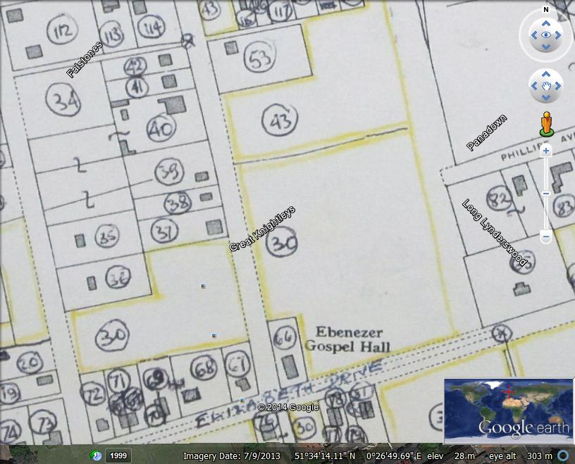
What I’m trying to find out is if there are any overlay maps of the area that cover the junction of Elizabeth Drive and Raleigh Drive? There was a house right on one corner of the intersection and opposite was Ebenezer Hall. The house that I was born in was called ‘Kenwood’ and was next to the house on the corner.
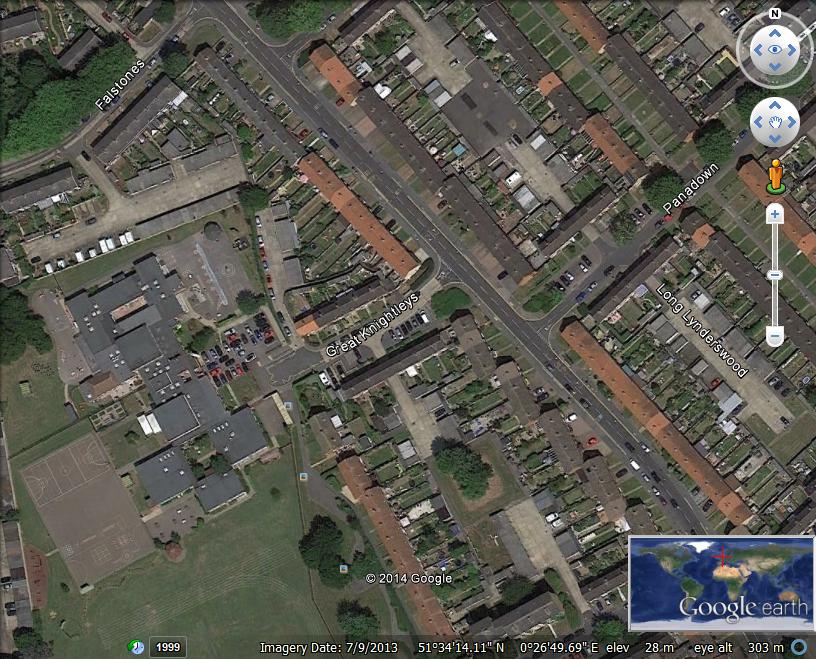
Editor: As requested Jeff, I have added a series of three maps that show an overlay of the 1949 Basildon Development Corporation map superimposed onto Google Earth. Click on each map to enlarge
The notes from the survey, list the property names as follows. 66 Ebenezer Gospel Hall 67 Cosynook 68 Kenwood 69 Rosebay 70 Winnick 71 Sunnyside 72 Frances


No Comments
Add a comment about this page