Nine of us set off from Tesco’s store and made our way towards the ridge via an unmade track that had dried out surprisingly well after yesterday’s storm. Four team members, Nina and Colin Humphrey, John Rugg, Sue Ranford and Paul Sargeant were accompanied by Trevor Hart and Paul’s mother June Sargeant. We were also delighted to be joined by two of my former school friends from Laindon High Road School, Graham Godward and his wife Christine (née Elliott). Christine lived with her parents in “Everest” in First Avenue and therefore was able to show us the exact spot at the junction of First Avenue and Hillcrest Avenue with just a little help from some maps. We walked around what had been the very large garden and located the position of the stand pipe, a few feet from the back of the bungalow. Christine recalled going to Dunton School and later on how she and other youngsters from the Avenues would catch the bus in Lower Dunton Road that took them to Laindon High Road School.
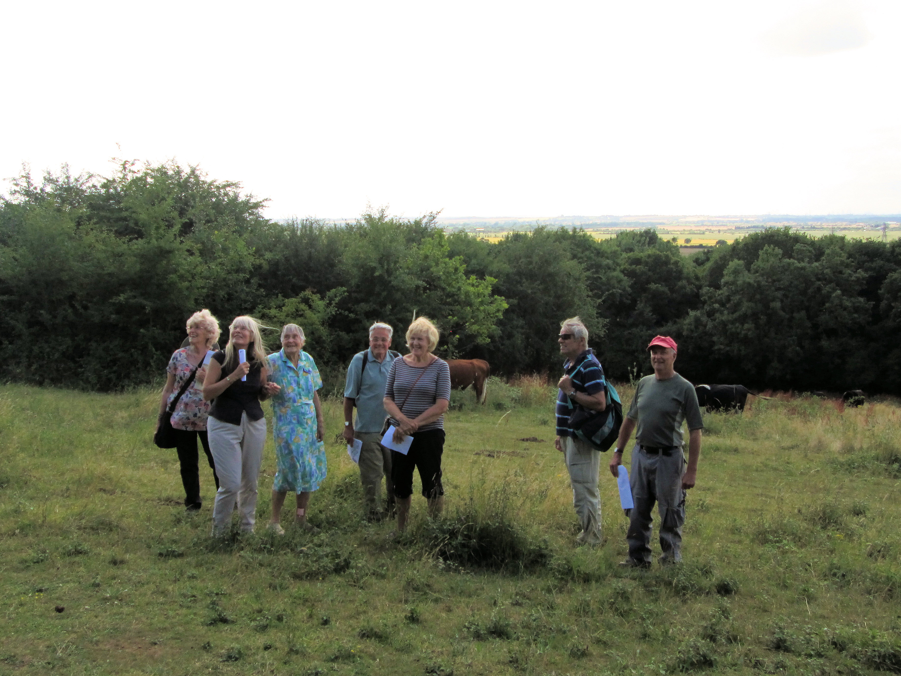
A fresh breeze relieved a very warm afternoon as we walked on to the meadow. Here we lingered a while to admire the view of the London skyline. It wasn’t the clearest of days but we could nevertheless make out Canary Wharf, The Shard, the Post Office Tower and London’s latest tall building, The Leadenhall Building, which is still under construction and nick-named ‘The Cheesegrater’. Upon wandering further into the meadow, there was no sign of the Exmoor ponies that were in the field last year, instead we came across a small herd of cows, obviously far too busy grazing to be bothered by us. Time was ticking on so we set off towards Dunton Park.
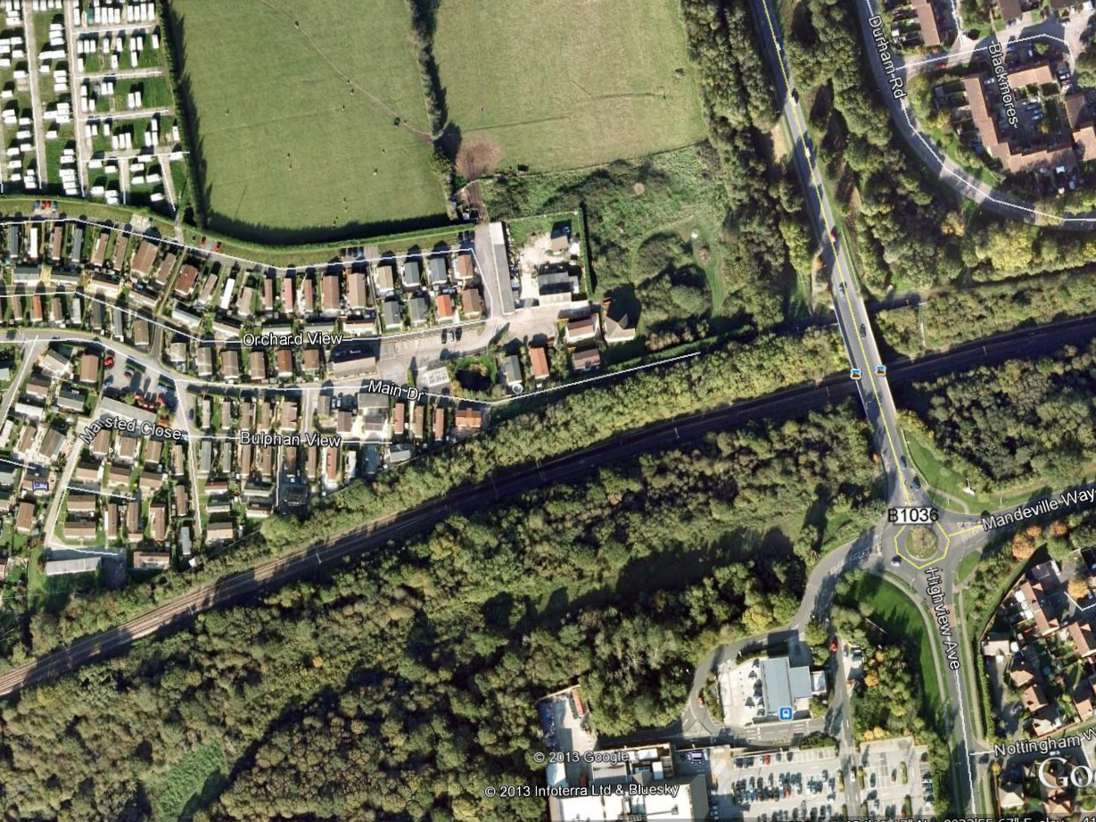
We continued around the track which runs along the side of Tesco’s until we reached the main road. Then turned left and crossed the railway bridge, turned left again and entered the former site of Sumpner’s Farm, which became the Poplar Labour Camp around 1903/04. This area, known as Dunton Park since around 1960, now houses both static residential mobile-homes and a storage area for touring caravans. We walked around ‘the village’ and were most impressed with the prettiness of the place with its beautifully kept homes and gardens. Although very quiet and peaceful, it has many facilities including its own Country Club. As we followed the path, we noticed the field to the north which houses the touring caravans and a little further on, the original Farmhouse, a solid looking, two storey building with boarded up doors and windows. We wondered why the building hasn’t been utilised and whether there are any plans for the future in that regard. At the east end of the complex there is a large ornamental pond which is shown on the 1922/38 ordnance Survey map as being a tank (Tk), perhaps created to provide a water reservoir for fighting fires.
At this point somebody noticed a black cloud coming our way from the east, so we quickly got into our stride. We arrived back at the car park at 4:45, to say our goodbyes after agreeing it had been a very pleasant afternoon. By then the black cloud had changed direction, disappeared and thankfully hadn’t rained on our parade.


 superimposed over the area as it is today.")


No Comments
Add a comment about this page