

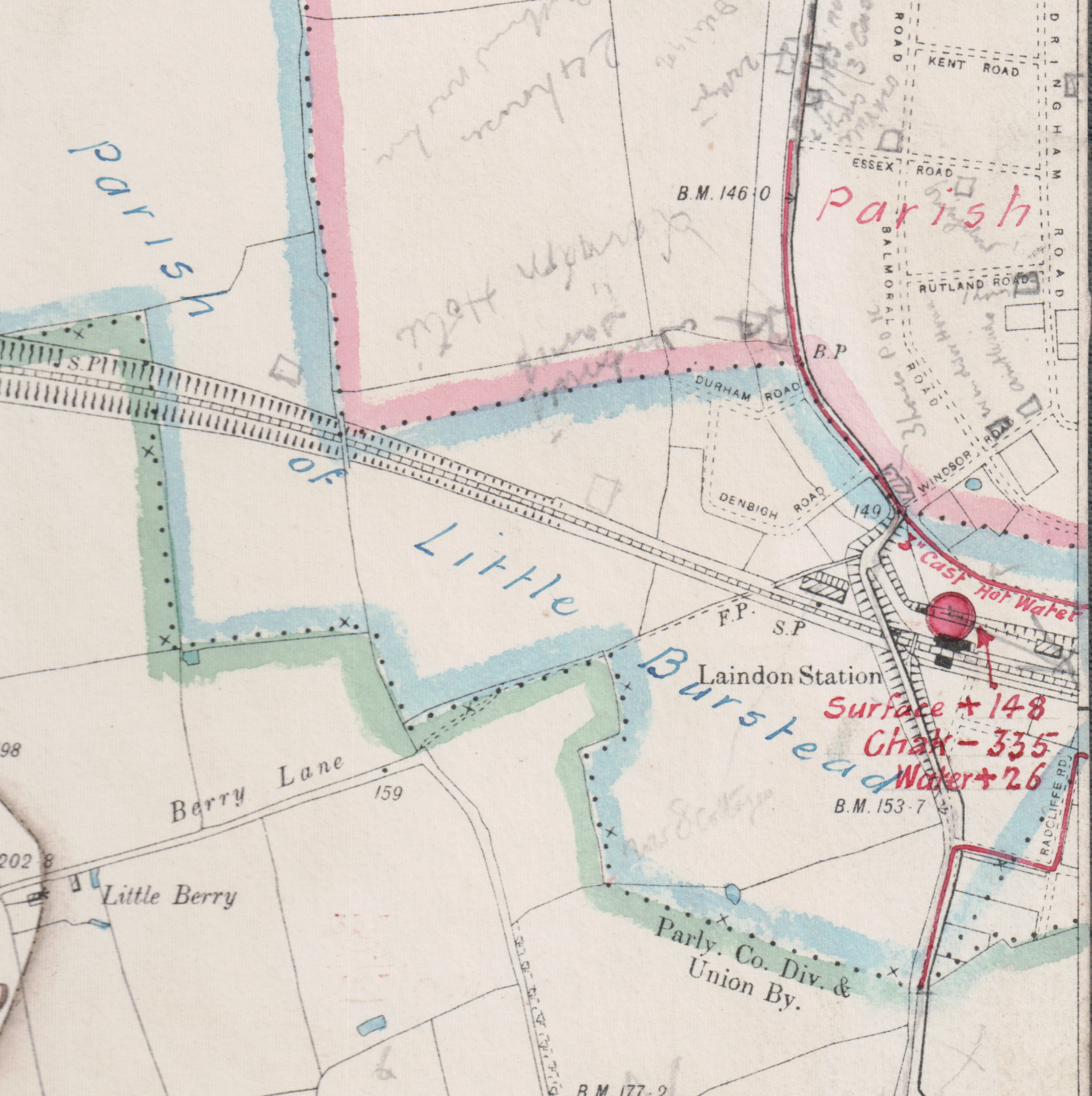
At the end of the 19th century, Henry Rofe (Professor of Engineering at Queens College Birmingham), produced maps showing the network of water supply and storage in many parts of the country. I have two of these maps, one of which shows Laindon and the surrounding area on a six inch to the mile O.S. map. Looking closely at the area around Laindon Railway Station, I have noticed that there is a red line that starts at Essex Road and runs south east towards the station. There it continues to turn towards the east and runs parallel to the railway line, (unfortunately the line disappears off the edge of the map and I do not have the next map in the series). The red line is marked as being ‘3″ cast hot water‘, I assume that this means hot water and is not a term used by the water company to describe a cold water pipe that is in someway special. If so, where would this water have been heated? Could it be that the gas works just to the east was responsible? Maybe the heat was a by-product of gas production. I would be very interested to know if anyone has information on the hot water pipe.
Interestingly the red line also appears on the south side of the railway line, it runs down Radcliffe Road and into High Road, Langdon Hills. Could it be that the hot water was used in the bathhouse that once stood in this area?


No Comments
Add a comment about this page